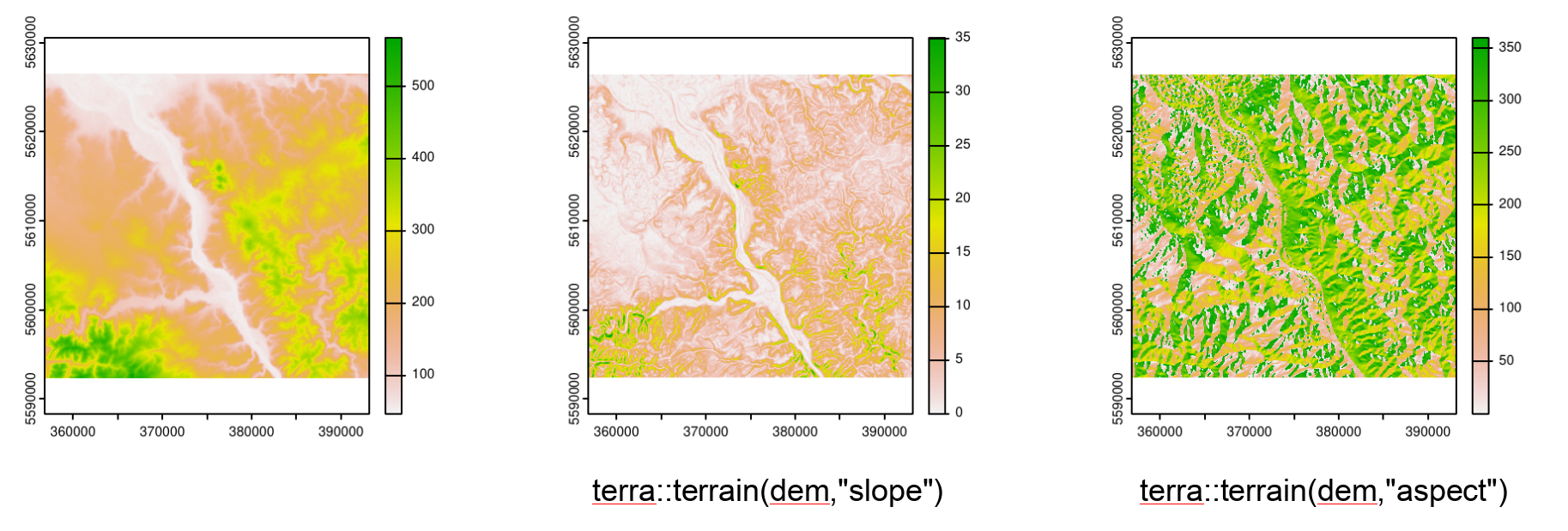
Simple terrain model processing
![]()
Why extrernal GIS Software?
- some functionalities not implemented in R but in QGIS, SAGA, GRASS, ArcGIS…
- e.g. tools in the field of hydrology and morphometry not common in R but in SAGA
- Links to functionalities via R Packages: RSAGA, rgrass7, RQIS, RPyGeo
- Workflow-centric in R
- no manual processing steps
- reproducible
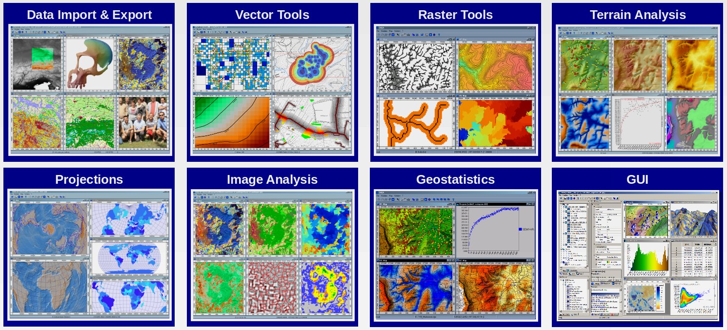
SAGA GIS
![]()
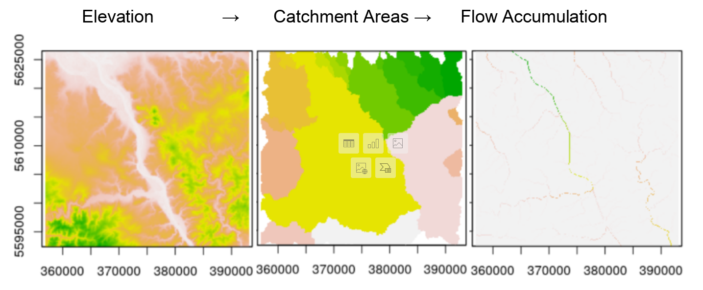
Task
![]()